Pedaling Through Paradise the Baja Divide
Bikepacking the Baja Divide: A Mad Monkey Adventure
Embarking on the Baja Divide is not just a journey—it’s a rite of passage for bikepackers seeking solitude, breathtaking landscapes, and an unforgettable adventure. Spanning 1,673 miles (2,695 kilometers) from Tecate to La Paz, the route winds through some of Baja California’s most rugged and remote terrain. For us at Mad Monkey Designs, it was an experience filled with challenges, triumphs, and a deep connection to the land.
Tackling the Baja Divide was more than just an adventure, it served as a rigorous testing ground for our fabric choices and bag designs. By navigating the demands of a route as formidable as the Baja Divide, we gained critical insights into the practicalities of bikepacking equipment. These experiences allowed us to evaluate bag durability, fabric performance, and the functionality of design features under the most challenging conditions. We hold firmly to the belief that the most thoughtful gear is created by those who test their designs in real-world scenarios, ensuring they meet the demands of the landscapes and journeys they are built to endure.

The Route: An Overview
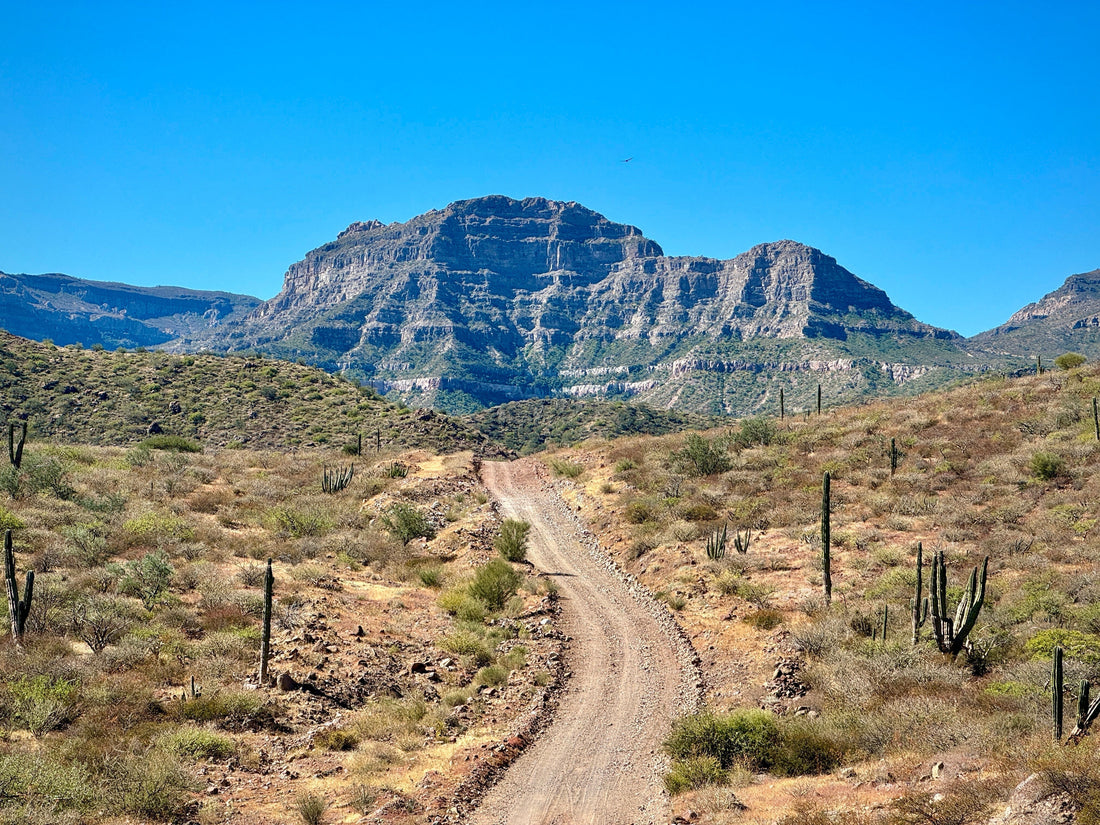
The Baja Divide is a backcountry bikepacking route that primarily follows dirt roads and lone race tracks through a diverse topographic landscape. Originally mapped out by Lael Wilcox and Nicholas Carman in 2015, this route is designed to immerse riders in Baja’s wild and arid beauty. The trail traverses two Mexican states, Baja California and Baja California Sur, passing through nature reserves, desert expanses, fishing villages, and mountain ranges. Expect to carry ample water, as resupply points can be far between, and prepare for long stretches of washboard roads.
For detailed maps and resources, check out bikepacking.com Baja Divide route resource page

Navigating with Gaia GPS
Throughout our journey, we relied on the Gaia GPS app for navigation. This powerful tool allows users to download detailed maps for offline use, ensuring access to crucial route information even in remote areas without cell service. By preloading base maps and specific route data, we could confidently traverse the challenging terrains of the Baja Divide.
Gaia GPS offers a variety of map sources, including topographic and satellite imagery, which can be layered to provide comprehensive insights into the terrain. The app's route planning features enabled us to mark waypoints, assess elevation profiles, and stay oriented throughout the expedition. For bikepackers tackling demanding routes like the Baja Divide, Gaia GPS is an invaluable companion.
By immersing ourselves in the Baja Divide's diverse landscapes and utilizing robust navigation tools, we not only tested our gear under real-world conditions but also gained a profound appreciation for the region's unique geological heritage.
Geology and Geography of the Baja Divide
The Baja California Peninsula, extending approximately 1,247 kilometers (775 miles) from the U.S. border to its southern tip, was once part of the North American Plate. Around 12 to 15 million years ago, tectonic activity along the East Pacific Rise initiated the peninsula's separation, leading to the formation of the Gulf of California. Today, the peninsula resides on the Pacific Plate, moving northwestward.
The route traverses several prominent mountain ranges, collectively known as the Peninsular Ranges. These include the Sierra de Juárez, Sierra de San Pedro Mártir, and Sierra de la Laguna. Composed mainly of Mesozoic granitic rocks, these ranges are part of the Salinian Block, sharing geological origins with California's Sierra Nevada.
Riders will encounter diverse landscapes, from arid deserts adorned with giant cardón cacti to coastal plains and volcanic terrains. Notably, the Tres Vírgenes volcanic complex, consisting of three stratovolcanoes—La Vírgen, El Azufre, and El Viejo—offers a glimpse into the region's volcanic past. La Vírgen, the youngest and tallest, last erupted in the Holocene epoch.


A Mad Monkey’s Trials and Tribulations
As I pedaled into the heart of Baja, it didn’t take long for the route to test my physical and mental strength. The first major trial came in the second section Tecate to Ojos Negros. Having vigorously trained in the states, I figured a 71-mile ride would be a cake walk. Oh, was I so wrong! Having planned to complete this section in 2 days max and only bringing enough water for such about 15 miles out of town I realized I had vastly under prepared in the water storage. The steep climbs and rocky terrain pushed my endurance to the brink. Yet, as I reached higher elevations, the pine forests provided shade, and the views were nothing short of spectacular. I camped at the peak of the climb, sleeping one of the coldest nights on the trail. In the morning as soon as the sun it my tent I was struck by the humbling experience as I stood amidst ancient peaks, knowing this range is one of Baja’s crown jewels.
The infamous sand tracks of Baja’s Vizcaíno Desert were another story altogether. Picture this: A monkey trudging through endless sand, bike in tow, under a blazing sun. The laughter comes only in hindsight! Yet, the stunning desert flora—giant cardón cacti standing like sentinels—kept us inspired to push forward.


The Magic of Baja Sunrises and Sunsets
One of the undeniable highlights of the Baja Divide is experiencing its sunrises and sunsets. Baja California’s skies seem to burn brighter and stretch wider than anywhere else. Each morning felt like a gift as we woke to fiery hues lighting up the horizon. One memorable evening near Bahía Concepción, the sky transitioned from golden yellows to deep purples, perfectly mirrored on the calm waters of the bay.


Wildlife Encounters: Dolphins at Bahía de los Ángeles
Nature has its own way of rewarding perseverance. After a grueling stretch of rough roads, we arrived at Bahía de los Ángeles, a small fishing village perched on the Sea of Cortez. That morning, while sipping coffee and watching the waves, a pod of dolphins appeared, gracefully leaping in the calm, glassy water. It was a surreal moment—a reminder of the wild beauty that makes Baja so special.


Baja California Sur: Villages and Valleys
As the route continues south, Baja California Sur welcomes riders with its charming villages and lush valleys. The Via de Curios, a series of small artisan markets, offered a chance to rest and connect with locals. Their warmth and generosity were as nourishing as the food they shared. Riding through these areas, we felt a profound appreciation for the cultural richness that punctuates Baja’s natural splendor.


Practical Information and Highlights
For those considering the Baja Divide, here are a few major landmarks and natural reserves along the route:
-
Parque Nacional Sierra de San Pedro Mártir – Home to Baja’s tallest peaks and lush pine forests. Learn more here.
-
Reserva de la Biosfera El Vizcaíno – A UNESCO World Heritage Site and the largest wildlife refuge in Latin America. Explore it here.
-
Bahía Concepción – Known for its turquoise waters and tranquil camping spots. Details available here.
-
Sierra de la Laguna Biosphere Reserve – Lush oak and pine forests with stunning views near the southern end of the route. Read more here.
Final Thoughts
Bikepacking the Baja Divide is not just a physical challenge but a journey into the heart of Baja’s wilderness. From the trials of sandy deserts to the triumphs of sunrise-soaked mornings, every moment leaves an indelible mark. If you’re ready to embrace the wild and carry your own slice of Mad Monkey spirit, this route will not disappoint.
Got questions about our journey or want custom bikepacking gear to take on your own Baja Divide adventure? Drop us a message—we’d love to help!
